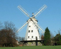
Upminster 001

People did live permanently in Upminster before the Roman invasions. These people (called "ancient Britons", "Celts", or "Belgae" because of similar pottery in Flanders) were farmers.
In southern Upminster, we can still see the landscape that they created. A glance at the Ordnance Survey map shows how the field and road boundaries in the south, and alongside the Ingrebourne, are mostly rectilinear.
In the north it is quite different: the map is very irregular, making cobweb shapes, and other chaotic patterns. This rectilinear landscape is very ancient. The land round here, if left uncultivated, rapidly reverts to woodland, and these field boundaries, in the south, are probably unchanged since the Bronze Age.
The archaeologists have just completed a major dig at Hunts Hill Farm (a bit south of Harwood Hall), and although their report is awaited, it is clear that people lived in Upminster, from about 500 BC.
St. Mary's Lane may be a very old road, dating from these times of the earliest agriculture in Upminster.

